Explore Owen Sound's natural attractions on foot, including waterfalls and rivers, cliff-tops, crevices, and shorelines. They are exciting in all seasons and most are accessible by snowshoe in the winter.
Trails form ribbons throughout Owen Sound with connectors to the Bruce Trail, the longest and oldest footpath in the country, and to the Tom Thomson Trail, a 41-kilometre route from Owen Sound to Meaford. A paved harbourfront walkway with historic interpretive plaques stretches along each side of the Owen Sound harbour. Check out the Grey Sauble Conservation Authority trails as well.
If hiking in rural or wooded areas, please wear sturdy shoes and bring a water bottle, hat, sunscreen and insect repellant, depending on the season. Bruce Trail maps are available at the Owen Sound Visitor Centre.
The Owen Sound Trails Network brochure also offers helpful information as you explore the region.
Distance: 1.5 km
Difficulty: Easy
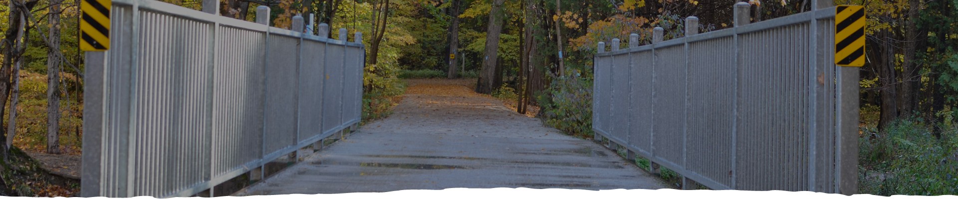
The Harrison Park loop is a beautiful walk through hardwood forest and open parkland on wide, hard-packed trails following the Sydenham River. It's accessible in all seasons and a popular place to snowshoe or cross-country ski in winter. The loop begins at the trail head and kiosk just east of the park entrance off 2nd Avenue East. It follows the river south to the Freedom Trail, commemorating the first black settlers of Owen Sound, the most northern "station" on the Underground Railway. Stop to view the Black History Cairn, and the interpretive plaques around it.
The trail continues south towards the Harrison Park Inn, crossing the bridge near the duck pond to the east of it. Here, you will see blue blazes marking the Bruce Side Trail. Follow the trail south and across another bridge leading into the campground. Continue west past the pool to the Weaver's Creek Boardwalk and discover one of Owen Sound's treasured waterfalls, just beyond the boundary of Harrison Park. Be mindful that this is on private property. Quiet roads will take you back to the playgrounds and Harrison Park Inn, where you can fuel up with a meal or snack. The trails will lead you back to your starting point.
Distance: 3 km
Difficulty: Easy
Explore Owen Sound's harbour along this 3-kilometre trail that stretches from Kelso Beach Park to the city's East boat launch, with historic plaques along the way. The trail passes by the Visitor Information Centre and Community Waterfront Heritage Centre, as well as the Harry Lumley Bayshore Community Centre, offering gardens, a playground and small beach. The waterfront trail links with the Tom Thomson Trail to the east and the Georgian Bluffs Rail Trail to the west. The trail is not maintained in winter.
Distance: 7.4km of looped trails
Difficulty: Varied
Severals trails fan out from Inglis Falls, the most popular waterfall in the region, with linkages to Harrison Park, the West Rocks, Jones Falls and the city's Centennial Tower. The Bruce Trail is the main artery with side trails offering shorter, looped hikes within the Inglis Falls Conservation Area. Features include more than 20 species of ferns, bird watching, glacial potholes and an expansive view of the Owen Sound valley and harbour. Salmon and trout spawn in the Sydenham River below. Open year-round for hiking, snowshoeing and cross- country skiing. Nominal parking fee in peak season. Access off Inglis Falls Road, north of Country Road 18
Distance: 1.8km
Difficulty: Moderate to Difficult
The Palisades loop of the Bruce Trail offers a rare chance to hike the lower talus of the Niagara Escarpment, hugging cliff walls that slope down to the Owen Sound valley below. The trail is rugged in areas, but showcases a spectacular range of flora, fauna and rock formations.
Access the trail from the south end of 7th Avenue East where the pavement ends. From the trail head on the east side of the street, walk a short 75 metres and turn right onto the Palisades Side Trail, marked with blue blazes. The trail climbs to an intersection with the Bruce Trail; turn left to complete a shorter loop back to the trail head, or continue on the Palisades Side Trail south, where it meets the main trail again. Turn left to continue the Palisades loop, heading uphill over rocky terrain to a spectacular canyon with cliffs towering over you on both sides.
You can reach the summit of the escarpment - the Raven's Nest - by taking a short side trail to the lookout.
Back on the main trail heading north keep your eyes open for an unmarked, narrow opening in the cliff face on your right. It leads to the "Devil's Playhouse," an enclave with rock "benches" and an overhang serving as a roof -- one of nature's many wonders on this loop.
The trail continues north to the Harrison Park Side Trail on your left; follow the blue blazes back to the trail head.
Distance: 0.5km
Difficulty: Moderate to Difficult
The Nine Bends Trail is one of many paths in Owen Sound that offer pedestrians a short-cut through the escarpment from one street to another. The Nine Bends is a steep, windy path that connects 1st Street West near Harrison Park to the Greenwood Cemetery.
Distance: 45 km in the Owen Sound area
Difficulty: Easy to difficult
The Bruce Trail is the longest and oldest footpath in Canada, stretching 886 kilometres from Niagara Falls to Tobermory along the Niagara Escarpment - a recognized world biosphere reserve. The trail forms a ribbon around Owen Sound, linking the Centennial Tower, Harrison Park, Inglis Falls, the West Rocks and Jones Falls. Look for white painted "blazes" on trees along the Bruce Trail to mark your path. Blue blazes denote a side trail. Members of the Sydenham Bruce Trail Club maintain the trails in this area. Bruce Trail guides are available at the Owen Sound Visitor Information Centre or from www.brucetrail.org.
Distance: .7 km
Difficulty: Challenging
The 20-minute hike along Indian Creek is vigorous, with steep hills and rocky terrain, but you are rewarded with sheer beauty when you reach Indian Falls, a 15-metre cascade at the end. The horseshoe-shaped waterfall is similar in formation to Niagara Falls. Parking available at the trail head off County Road 1 north of Owen Sound. Trail not maintained in winter.
Distance: 6 km of looped trails
Difficulty: Varied
The Pottawatomi River cascades 12 metres over the escarpment at Jones Falls, just west of Owen Sound. The trail cuts through large clusters of white and red trilliums in the spring and leads to a wonderful view of the surrounding lowlands. Cross the bridge for the best views, but watch your footing on the rocky terrain. Parking available at the Grey-Bruce Visitor Centre on Highway 6.
Distance: Various
Difficulty: Moderate
The Georgian Bluffs Trail and the CP Rail Trail are two former railway trails open to the public. The hard-packed dirt and gravel trails are used primarily by off-road cyclists and snowmobilers. Access the Georgian Bluffs Trail from County Road 1 just north of the Georgian Shores Marina, where it continues 16 kilometres through scenic farmland to Park Head. The CP Rail Trail is 77 kilometres long, with coarse gravel in the southern sections.
Distance: 4.5 km of looped trails
Difficulty: Easy
The Hibou conservation area sports two natural, sandy beaches and 4.5 kilometres of gentle, flat trails and boardwalks. Enjoy the 1.2-km Point Loop on the waterfront or the Main Trail, on the other side of the road. Park at the trail head on Highway 15, a short drive east of Owen Sound. Also accessible by bike via the Tom Thomson Trail. Open year-round, with snowshoeing and cross-country skiing in winter. Nominal parking fee in peak season.
Distance: 2 km of looped trails
Difficulty: Easy
Stoney Orchard Park offers several kilometres of flat, wide stone dust trails accessible to all recreational users. Along the western edge, marvel at the cliff-top views of Georgian Bay below. The trail system links with quiet city streets and paths to offer access to a number of other areas, including the Kiwanis Soccer Complex, the Tom Thomson Trail, the Harbourfront Trail, Heritage Place Mall, the Julie McArthur Regional Recreation Centre and downtown Owen Sound. Parking available off 23rd Ave. East near Ecole St. Dominique Savio. Open all seasons.
Distance: 43.4 km
Difficulty: Easy to Challenging
Named after the iconic Canadian painter Tom Thomson, this recreational cycling trail leads from Owen Sound to Leith, the small village that Thomson called home during his childhood years, and the place he is now buried. The Hibou Conservation Area and trails are just beyond the village. The Tom Thomson Trail continues on to Meaford, where it connects with the Georgian Trail to Collingwood.
Distance: 13 km, looped trails
Difficulty: Moderate
The West Rocks trail system consists of the Bruce Trail, offering spectacular views of the City and beyond from the western bluffs, and the Brant Tract trails that loop behind the main trail and are often used by cyclists. A feature of the West Rocks trail is the former limestone quarry that provided the foundation of many historic homes in Owen Sound. You can access the West Rocks Trails on foot at 7th Street West and 7th Avenue West.
The city of Owen Sound lies in a river valley carved deep into the Niagara Escarpment with numerous hills and cliff-tops that present challenges in terms of getting around. The solution: pedestrian "catwalks" or paths linking streets to one another. Owen Sound has many of these short-cuts, some iron stairways (maintenance-free in winter), and some paved pathways. Most are steep and not for the faint of heart.